History
The Rocky Cape area that surrounds Sisters Beach was formed at least 100 milllion years ago, when this part of Tasmania was connected to parts of North America (Colorado) – the local rocks are some of the oldest in Tasmania.
The human history of the area goes back at least 8,000 years, with one of Tasmania’s most significant archeological sites at Rocky Cape point. The two caves there show continuous human occupation from before when Tasmania was connected by land to Victoria.
On his mission to collect together Aboriginal people from the area and take them to Flinders Island, Augustus Robinson and a group of local Aboriginal people camped at Sisters Beach in July 1830. Robinson recorded that the name these people used for the bush around Sisters Creek was ‘munrawna’. Sisters Island, just out from the beach, was called ‘layranti’ and Rocky Cape, in the distance, was called ‘pinmatik’.
The palawa who lived here were the Tommeginer tribe of Table Cape, one of the eight tribes that made up the northwest linguistic group of Aborigines, a loose knit, social and economic confederation of maritime tribes that occupied the Northwest. The way they interpreted this land, used it, and respected its intrinsic values adds a layer of history that is a fascinating foundation to the story of this place. This foundation is not lost and remains in the landscapes and in the stories of the indigenous people but understanding it is difficult for many of us, who are unfamiliar with the lore and culture of the first peoples.
A little more of the indigenous history of this region can be found on the Waratah-Wynyard Council’s website here.
We hope to add to this and shed a little more detail on this history on these pages and are in the process of respectfully gathering these insights. We hope to share them when we can.
In relation to the area’s European history, the Wynyard Historical Society was kind enough to share the following insights:
The Postman’s track was the first land route between the first two European settlements on the Northwest Coast, Circular Head and Emu Bay, and was described by Henry Hellyer in 1830 as “an execrable track.” Part of this track ran along the beach at Sisters Beach.
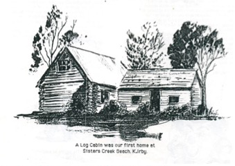
L G Irby and family were the first permanent European dwellers, settling there in 1934, and residing in a log cabin. Mr Irby was interested in forestry and maintained declared that the so called “wastelands” of button-grass plains and heath-lands could be utilised for pine plantations and pastures. The family built a track from the Boat Harbour turnoff, and by the 1950s people started driving in and the beach became a popular place to visit. There were about 25 shacks there at this time.
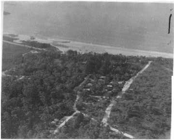
In 1967 Rocky Cape National Park surrounding Sisters Beach was declared, because of its archeological significance, its intact heathland and coastal woodland (including serrated banksia stands) and the abundance of threatened Tasmanian devils, bandicoots, quolls and other wildlife.
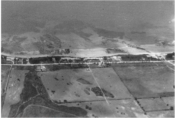
Since then, Sisters Beach has become a popular holiday destination, and jumping off point to explore the walking tracks running through the National Park, and there are many shacks and permanent homes.
Local shops and services